Category Archives: In General

What to Wear & Bring Along

Download What to Wear & Bring Along (PDF format, 22KB) Updated 08-Jan-2009

  • Wear comfortable clothes
  • Foul weather gear or waterproof windbreaker in case of rain or heavy weather (unlikely)
  • White soled or non marking sneakers, or deck shoes (Please do not wear sandals, flip flops, black soled running shoes, or boots)
  • Jacket
  • Hat
  • Camera
  • Dramamine (or whatever keeps you from getting seasick)
  • Sunglasses and sunscreen
  • CA fishing license if you want to do some fishing
  • You must be in moderate physical condition, have good balance and be able to climb on and off a boat unassisted

What to Wear & Bring Along

What to Wear & Bring Along 2

Directions to Sunroad Resort Marina

Download Directions to Cabrillo Isle Marina (PDF format, 22KB) Updated 08-Jan-2009

  • Take I–5 south toward downtown San Diego
  • Take the Laurel Street. At Laurel Street turn right and head west toward the airport.
  • Laurel Street will merge into Harbor Drive
  • Continue driving west on Harbor Drive until you are in front of airport terminal 1
  • Make a left hand turn onto Harbor Island
  • Pass the first Sheraton Hotel building and follow the road to the left
  • You will pass San Park (Airport Employee Parking) on your left, and look for the sign that says “Sunroad Resort Marina”
  • Turn left into the marina parking lot. The marina office, yacht brokerages, etc will be on your right hand side.
  • Park in one of the guest spots
  • Walk to the marina gate labeled “A-D” on your far left, if you are facing toward the airport.
  • Call (619) 602-4435 to be let through the gate (or just wait for someone to open the gate)
  • Walk to “D” dock, the dock closest to the entry gate.
  • MERMAID is the 2nd boat down on the east side of the pier in slip D–4.

Boating Qualifications

Download Boating Qualifications(PDF format, 6.6MB) Updated 13-February-2012


Boating Licenses & Certificates

U.S. Coast Guard

Merchant Mariner Credential

(Document serial number: USA000112888, Reference number: 2574253)

•     Master, Near Coastal, 100 gross tons

•     Sailing Endorsement

•     Towing Endorsement

•     Operator of Uninspected Passenger Vessels

•     Standards of Training, Certification and Watchkeeping for Seafarers Endorsement

•     Transportation Worker Identification Card (TWIC)

Maritime Institute

•     Master Near Coastal NMT 100 Tons

•     Sailing Endorsement

•     Towing Endorsement

•     Standards of Training, Certification and Watchkeeping for Seafarers

United States Coast Guard Auxiliary

•     Sailing and Seamanship – “Engines”, “Tuning & Variant Rigs”, “Trailer Sailing”, “Equipment”, “Piloting” and “Radiotelephone” (1984 – Philadelphia)

•     Coastal Piloting – “Atlantic” (1983 – Philadelphia)

•     Coastal Piloting – “Pacific” (1987 – San Diego)

Sailboats, Inc.

•     Bareboat Charter Certificate (Auxiliary-powered sailing yachts)

California Department of Boating and Waterways
•     California Boating Safety

U.S. Sailing

•     Safety-at-Sea


FCC Amateur (HAM) Radio License – KI6MBK (Kilo India Six Mike Bravo Kilo)

•     General Class Operator

•     Technician Class Operator

Boat U.S.

•     Boat U.S. Delivery Captain Directory


American Red Cross Sailing & Small Craft Safety Instructor

•     Sailing Instructor (Expired)

•     Basic Sailing (Expired)

•     Canoeing Instructor (Expired)

•     Canoeing (Expired)


Member


•     Point Loma Yacht Club

•     San Diego Sail & Power Squadron

•     National Association of Charterboat Operators


Presentations

Presentations at national and regional boating conferences:

  • Offshore Cruising.  Southern California Yachting Association Women’s Sailing Convention, Corona del Mar, CA.  February 2009, 2010, 2011 and 2012.
  • Overboard Procedures.  Southern California Yachting Association Women’s Sailing Convention, Del Rey Yacht Club, Los Angeles, CA.  February, 2008.
  • Knot Know-how.  Southern California Yachting Association Women’s Sailing Convention, Corona del Mar, CA.  February 2007 and Del Rey Yacht Club, Los Angeles, CA.  February, 2008.
  • Electronic Navigation, Advanced GPS/RADAR. Southern California Yachting Association Women’s Sailing Convention, Corona del Mar, CA.  February 2006.
  • Navigation  201/202.  Southern California Yachting Association Women’s Sailing Convention, Corona del Mar, CA.  February 2005 and 2012.
  • Advanced Navigation.  Southern California Yachting Association Women’s Sailing Convention, Corona del Mar, CA.  February 2005.
  • Chartplotters.  Southern California Yachting Association Women’s Sailing Convention, Corona del Mar, CA.  February, 2004.
  • Suddenly Singlehanded.  Southern California Yachting Association Women’s Sailing Convention, Corona del Mar, CA.  February, 2003.
  • Grasping GPS.  Southern California Yachting Association Women’s Sailing Convention, Corona del Mar, CA.  February, 2003, 2004, 2005.
  • Navigation Rules of the Road – Memorization Made Easy.  International Boating & Water Safety Summit, Daytona Beach, FL.  May, 2002.
  • Coastal Piloting, Charting & Navigation Made Easy.  American Alliance for Health, Physical Education, Recreation and Dance, San Diego, CA.  April, 2002.
  • Basic Navigation 101.  Southern California Yachting Association Women’s Sailing Convention, Corona del Mar, CA.  February, 2002, 2003, 2004, 2006, 2007, 2009, 2010, 2011, 2012 and Del Rey Yacht Club, Los Angeles, CA.  February, 2008.


Days of Sparking Waters

Nights of Falling Stars
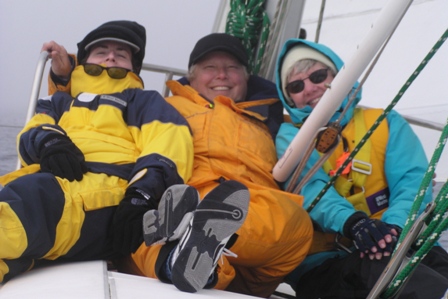
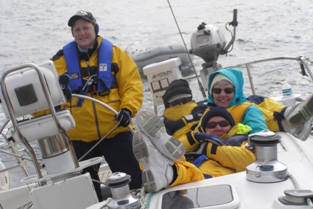
 
MERMAID

Capt. Alison Osinski


Additional Boating Experience


  • Sailboat deliveries along the Pacific Coast ranging from Puerto Vallarta, Mexico to Monterey, California
  • Mission specialist for a day aboard the research submarine Antipedes with Oceangate and the Undersea Voyager Project .  We dove to a depth of 747 feet east of Ship Rock, Santa Catalina Island.   Our dive plan was to: identify ecologically significant targets in two underwater canyons, and collect video and SONAR imaging.  (2010)
  •  Race crew member (fore staysail trimmer) aboard the 1930’s schooner Skookum III (2008, 2009)
  • Sailed aboard China Doll in the 2009 Sail Sea of Cortez Week races.
  •  Skipper (6 times: 2003, 2004, 2005, 2006. 2007 and 2010) Newport to Ensenada International Yacht Race
  • Sailed as a crew member aboard Pacific Bliss in the Sail Asia Rally 2005 – Darwin, Australia  through Indonesia to Bali
  • Sailed aboard Pura Vida in the 2007, and Serenity in the 2008 Baja Ha-Ha from San Diego to Turtle Bay – Bahia Santa Maria – Cabo San Lucas, then assisted with the boat deliveries through the Sea of Cortez to San Carlos / Guaymas in mainland Mexico
  • Contracted by California Cruisin’ (2003 – 2005), Harbor Island Yacht Club (2005 – 2007), Broad Reach Sailing (2005 – 2006), and Classic Sailing Adventures (2007) to run afternoon charters, whale watching trips, and captain corporate regattas in San Diego Bay and nearby coastal waters
  • Established Mermaid Charters (2001 – present), a division of Aquatic Consulting Services, to provide keel boat sailing lessons, boat handling skills and safety drills, instruction in navigation and rules of the road, boat deliveries, day sailing trips and Pacific Ocean cruises off Southern California and to the Channel Islands.
  • Thousands of days of sailing experience in the Caribbean, Atlantic, Pacific and Indian Oceans, Coral Sea, Sea of Cortez, and Great Lakes.
  • The Crew’s Nest – Lake Erie – Put-in-Bay, Ohio.  (Summers of 1975, 1976).  Worked for a yacht club “The Crew’s Nest”.  Took sailing lessons, helped do boat deliveries back to the mainland, and spent at least 1 day per week exploring the Lake Erie islands.
  • University of Maryland – College Park, MD.  Graduate Teaching Assistant – Canoeing Instructor.  Taught canoeing classes Fall 1978, Spring 1979, Fall 1979, Spring 1980 semesters, 2 – 4 days per week, 16 week semesters, 2 –3 classes per day.  Once per semester, I ran the “Tour of the Monuments” canoe trip on the Potomac River.
  •   Crew coach, George Washington University, 1978 through 1980 seasons.
  • Camp Tegawitha – Mt. Pocono, PA (Summer 1973).  Small craft instructor and aquatic camp counselor
  • Water skiing – recreational.  Experienced with a variety of ski equipment, para sailing, and PWC in diverse water settings.
  • Retained by the San Diego Police Department Mission Bay Harbor Patrol Unit (1986) to provide advice on boating safety, swimming and rescue skills needed by police officers give responsibility for patrolling Mission Bay.
  • Spent a summer (1983) in western Africa (Republic of Mali) – traveled by ferry, barge and dugout canoe up the Niger River to Timbuktu.
  • Sailed as a crew member aboard the tall ship Californian from Dana Point, California to Hilo, Hawaii; and from Sausalito to the Farallon Islands
  •  Cruised Alaska’s inside passage by ferry; explored small Alaskan towns and Glacier Bay National Park by kayak.
  • Spent several weeks (in 1992, 1998 and 2005) on a variety of boats exploring, fishing, and SCUBA diving on the Great Barrier Reef, Australia.


Expert Witness

Boating – PWC – Water Skiing Cases

Retained as an expert witness to work on 40 boating/PWC/water skiing accident cases.


Consultant to:         Law Office of Philip H. Lowenthal

Location:                    33 N. Market Street, Suite 101

                                    Wailuku. HI 96793

Year:                           2012

Involvement:              State of Hawaii v. Eric Olbrich.  Defendant.  Criminal case.  Capt. Olbrich was taking a group of tourists on a snorkeling trip just outside of Kaumalapau Harbor on Lanai.  Mr. Amoncio, who was wearing a camouflaged wetsuit and spearfishing with his wife about 250-300 yards outside of the breakwall, surfaced right in front of the vessel being operated by Olbrich.  Amoncio was struck by the vessel and fatally injured.

Reference:                Samuel G. Mac Roberts, Esq.

                                    (808) 242-5000 (O), (808) 242-1500 (F), sgm@lowenthal-hawaii.com


Consultant to:           Demas & Rosenthal

Location:                    701 Howe Ave., Suite A-1

                                    Sacramento, CA 95825

Year:                           2011

Involvement:             Keller v. Sanfilippo, Rola, et al.  Plaintiff. Boating fatality on Lake Tahoe.  Prop injury.  Victim was a 46 year old dentist who was standing at the stern of a 22 foot powerboat boat as they approached the dock.  The vessel operator, who had had less than 3 hours of boating experience, was having difficulty maneuvering.  The operator knocked the victim off the boat, ran him over, and severed his leg.  The victim bleed to death before help arrived.

Reference:                John Demas, Esq.

                                    (916) 442-9000 (O), (916) 441-6444 (F), jdemas@demasandrosenthal.com


Consultant to:           Thurswell Law Firm

Location:                    1000 Town Center, Suite 500

                                    Southfield, MI 48075-1221

Year:                           2011

Involvement:             Randall/Oliver v. Bankston.  Plaintiff.  A bass boat capsized on Lake St.Clair when the outboard motor stalled in deteriorating wind and weather conditions.   Both men were thrown into the water wearing PFDs.  The vessel operator suffered hypothermia and his passenger drowned. 

Reference:                Cary Makrouer, Esq., (248) 345-2222 (O), (248) 345-2323 (F)

Consultant to:           Law Offices of Keith J. Stone

Location:                    555 West Beech Street, Unite 210

                                    San Diego, CA 92101

Year:                           2010

Involvement:             Freedie v. City of San Diego, La Jolla Kayak & Co.  Plaintiff.  Collision between a rental kayak and swimmer at La Jolla Shores.

Reference:                Keith Stone, Esq., (619) 531-2022 (O), (619) 531-8824 (F)


Consultant to:           The Gomez Law Firm

Location:                    625 Broadway, Suite 1200

                                    San Diego, CA 92101

Year:                           2010

Involvement:             Reynolds v. Hinsley  Plaintiff. Operator hit a wake while driving a speedboat at an excessive speed.  Passengers sitting in the open bow were thrown from their seats, and Ms. Reynolds broke her back.

Reference:                Amy Collins, Esq., (619) 237-3490 (O), (619) 237-3496 (F)

                                    www.thegomexfirm.com


Consultant to:           Law Offices of Keith J. Stone

Location:                    555 West Beech Street, Suite 210

                                    San Diego, CA 92101

Year:                           2009

Involvement:             Miller v. Kinsella.  Plaintiff.  Mr. and Mrs. Miller were out for a dinghy ride in Glorietta Bay on the 4th of July, 2006 and heading to the Coronado Yacht Club for the festivities, when a 16 year old man shot a high pressure water cannon right in Mr. Miller’s ear, “blowing out” his inner ear.  Defendant claimed the Millers were in a “soak zone” and you assume all risk of getting wet.

Reference:                Keith J. Stone, Esq., (619) 531-2022 (O), (619) 531-8824 (F)


Consultant to:           Law Offices of Robert Piering

Location:                    455 Capital Mall, Suite 350

                                    Sacramento, CA 95814

Year:                           2009

Involvement:             Rubenstein v. Abbattieolo.  Plaintiff.  Collision between a powerboat and a kayak resulting in the death of the kayaker.  Decedent was a 53 year old woman participating in nighttime full moon guided kayak trip.

Reference:                Robert A. Piering, Esq., (916) 446-1944 (O), (916) 446-1222 (F) rob@pieringlawfirm.com


Consultant to:              Moriarity, Badaruddin & Booke

Location:                          124 West Pine Street

                                    Missoula, MT 59802

Year:                           2009

Involvement:             Stickel v. Watercraft Adventures.  Plaintiff.   Mr. Stckel was injured when a rental PWC collided with his jet boat while operating on the Colorado River near Laughlin, Nevada.

Reference:                  Minot Maser, Esq. and Tina Sunderland, Senior Paralegal

                                    (406) 728-6868 (O), (406) 728-7722 (F), www.mbblawfirm.com

Consultant to:           Dreyer, Babich, Buccola & Callahan

Location:                    20 Bicentenial Circle

                                    Sacramento, CA 95826

Year:                           2009

Involvement:             Hullen v. Wray.  Plaintiff.  Mother died and son was injured when the WaveRunner they were riding collided with a boat driven by Wray in the California Delta. 

Reference:                Joseph Babich, Esq., (916) 379-3500 (O), (916) 379-3599 (F), www.dbbc.com


Consultant to:              Law Office of Rocky C. Copley

Location:                          550 West C Street, Suite 1150

                                    San Diego, CA 92101

Year:                           2008

Involvement:             Burk v. Grano.  Plaintiff .  Boating accident which occurred on San Diego Bay when the defendant ran his boat over a wake at high speed causing two passengers seated on the rear bench seat to be ejected from the boat

Reference:                Rocky Copley, Esq.

                                    (619) 232-3131 (O), ((619) 232-1690 (F)


Consultant to:           Tosdal, Smith, Steiner & Wax

Location:                      401 West A Street, Suite 320

                                          San Diego, CA 92101

Year:                        2008

Involvement:             Colombo and Slagel v. Kohl, Mission Bay Jet Sports, et al.  Plaintiffs.  Two young women suffered orifice injuries requiring surgery when intentionally thrown off a PWC by an operator  who accelerated rapidly and made tight turns at high speeds.

Reference:                Thomas Tosdal, Esq. and Ann Smith, Esq.

                                    (619) 239-7200 (O), (619) 239-6048 (F), ttosdal@tosdalsmith.com


Consultant to:            Friedberg & Bunge

Location:                       610 w. Ash Street, Suite 1400, P.O. Box 6814

                                    San Diego, CA 92166

Year:                           2008

Involvement:             Kurtenbach v. Sundiver, Inc., Ray Arntz.  Plaintiff .  Commercial dive boat employee was injured when a heavy boat hatch closed on her head.

Reference:                Thomas Friedberg, Esq.

                                    (619) 557-0101 (O), (619) 557-0560 (F)


Consultant to:            Casey, Gerry

Location:                       110 Laurel Street

                                    San Diego, CA 92101

Year:                           2008

Involvement:             Fullington / Goetz v. Horizon Divers, et al.  Plaintiff.  Drowning death during a scuba dive at Webster Point at Santa Barbara Island. Decedent was an experienced diver, on an organized 3 day lobster diving trip, who became separated from his assigned buddy. 

Reference:                Frederick Schenk, Esq.

                                    (619) 238-1811 (O), (619) 544-9232 (F), www.cglaw.com


Consultant to:           Dreyer, Babich, Buccola & Callahan

Location:                    20 Bicentenial Circle

                                    Sacramento, CA 95826

Year:                           2007

Involvement:             Kohler v. Rayzor.  Plaintiffs.  Big Cat Poker Run boating accident which occurred during a high speed race in the Sacramento Delta.  Plaintiffs suffered shoulder and spinal injuries and lacerations in the accident which involved the collision of seven boats. 

Reference:                Roger Dreyer, Esq., (916) 379-3500 (O), (916) 379-3599 (F), www.dbbc.com


Consultant to:           Dreyer, Babich, Buccola & Callahan

Location:                    20 Bicentenial Circle

                                    Sacramento, CA 95826

Year(s):                      2007

Involvement:             Bell v. Montz, and Mastercraft.  Plaintiff.  Boating accident on Lake Oroville in Northern California.  Boat was a 24-foot, open bow, Mastercraft X45 with 18 people on board.  The operator was trying to tow a wake boarder, couldn’t get up on a plane, so he had 8 passengers move forward to the bow.  When the operator slowed the boat after the wakeboarder fell, several passengers, including the 19 year old plaintiff washed off the boat.  The operator drove in a circle and ran over two women in the water.  The plaintiff suffered numerous injuries from coming in contact with the prop injuries, including brain damage.

Reference:                Robert Bale, Esq., (916) 379-3500 (O), (916) 379-3599 (F)


Consultant to:           Law Offices of Donald J. Deshaw

                                    (In-house Counsel for Safeco Insurance)

Location:                    2730 Gateway Oaks, Suite 210

                                    Sacramento, CA 95833

Year(s):                      2006

Involvement:             Thornton v. Perdock.  Defendant.  The boating accident occurred at 9:30 pm on Clear Lake, a large inland lake in northern California.  The defendant is a deputy sheriff who collided with a sailboat that was operating without running lights.  There were several passenger injuries and one fatality in the sailboat. 

Reference:                Sheila Gonzalez, Esq.; (916) 923-9505(O), (888) 879-2169 (F)


Consultant to:           Dreyer, Babich, Buccola & Callahan

Location:                    20 Bicentenial Circle

                                    Sacramento, CA 95826

Year(s):                      2006

Involvement:             Cockrell & Wagner v. Williams Sport Rentals.  Plaintiffs.  Extended family vacation on Lake Tahoe.  Adults rented PWCs for teenage family members.  Marina allowed a 7 year old to sit in front of the 14 year old driver.  Seven year old Jordan Cockrell and 14 year old Ashley Wagner were killed in a collision with their 15 year old cousin Derek Cockrell.  Case involves issues relating to duties of a boat rental company.

Reference:                Roger Dreyer, Esq., (916) 379-3432 (O), (916) 379-3599 (F)


Consultant to:           The Gomez Law Firm

Location:                    625 Broadway, Suite 1104

                                    San Diego, CA 92101

Year(s):                      2006

Involvement:             Chiquete v. Seaforth Boat Rentals.  Plaintiff.  PWC / motorboat collision.  Seaforth Boat Rental mechanic test riding an 18’ Searay bowrider with a 115 hp Mercury outboard, and a Yamaha Waverunner had a t-bone collision while running northbound near Government Island and the western shore of Fiesta Island on Mission Bay.  A 7 year old child who was a passenger on the Waverunner was seriously injured in the collision, suffered head trauma and is still in a coma.

Reference:                Maria Palmieri, Esq. and John Gomez, Esq., (619) 237-3490


Consultant to:           Dreyer, Babich, Buccola & Callahan

Location:                    20 Bicentenial Circle

                                    Sacramento, CA 95826

Year(s):                      2006

Involvement:             Gilday v. Thunderboats, International Hot Boat Association.  Plaintiff. Accident involves the IHBA sanctioned, Thunderboat drag race sponsored event on Mission Bay.  Rescue crews relayed information about safety of the course and race conditions via radio.  The sanctioning body and master of ceremonies ignored the information about rolling waves and debris relayed by the rescue crews, and allowed the race to proceed.  Mr. Gilday was seriously injured when his boat became airborne, crashed and disintegrated.

Reference:                William Callaham, Esq., (916) 379-3432 (O), (916) 379-3599 (F)


Consultant to:           Thorndal, Armstrong, Delk, Balkenbush & Eisinger

Location:                    6590 S. McCarran Blvd., #B

                                    Reno, NV 89509

Year(s):                      2005 – 2006

Involvement:             Minasian v. Farahi.  Defendant.  Mr. Farahi was operating his boat on the Nevada side of Lake Tahoe on July 4th when a rental PWC operated by the plaintiff turned suddenly to port right in front of him and caused a collision. The accident occurred when the PWC operator’s hat blew off and she made an attempt to pick it up.

Reference:                Steve Balkenbush, Esq., (775) 786-2882


Consultant to:           Darrell Palmer, Esq.

Location:                    2869 India Street

                                    San Diego, CA 92103-6011

Year(s):                      2005

Involvement:             Imlay v. Seaforth Boat Rentals.  Plaintiff. Mr. Imlay and his wife were invited to go boating with friends who had won a free boat rental from Seaforth.  The group went out on Mission Bay in the 21’ ski boat.  While in the Mission Bay channel the boat was hit by a large wake and came out of the water, throwing Mr. Imlay who broke his back.

Reference:                Daryl Palmer, Esq. and Mark Miller, Esq.; (619) 293-3100


Consultant to:           Thorsnes, Bartolotta & McGuire

Location:                    2550 Fifth Ave., Eleventh Floor

                                    San Diego, CA 92103

Year(s):                      2004

Involvement:             Bucci v. Seaforth.  Plaintiffs. Four teenage girls visiting San Diego from Rye, NY went to Seaforth to rent a boat.  The girls told the Seaforth employee that they had no experience with boats or tubing.  The Seaforth employee attached the tube, gave the girls a few minutes of instruction on how to use the boat, told them it was okay to ride double, and told them how to get to the ski area in Mission Bay.  After stalling out, calling and waiting for help that never arrived, the girls were able to get the outboard re started and began tubing.  A short time later, the operator lost the ability to steer the boat and ran over the two girls in the water.  Injuries included skull fractures, brain damage, spinal injury, and massive cuts.

Reference:                Kevin Quinn, Esq., (619) 236-9363


Consultant to:           Dranoff and Patrizio

Location:                    117 South 17th Street, Suite 1600

                                    Philadelphia, PA 19103

Year(s):                      2004

Involvement:             Estate of Thomas Bray v. United States of America (USCG), and the City of Philadelphia. Officer Bray, a member of the City of Philadelphia’s marine unit, drowned in the Delaware River when he became entangled and ran out of air while SCUBA diving.  Officer Bray was on the job and working with the U. S. Coast Guard to recover a sunken buoy.

Reference:                Arnold Dranoff. Esq., (215) 569-2121

Consultant to:           Bradley & Gmelich

Location:                    535 N. Brand Blvd., 9th Floor

                                    Glendale, CA 91203

Year(s):                      2004

Involvement:             Lindberg v. Maio.  Defendant .  Mr. Maio’s boat collided with a neighboring boat while docking at the San Diego Yacht Club.

Reference:                Jonathan Ross, Esq. (818) 243-5200


Consultant to:           Thorsnes, Bartolotta & McGuire

Location:                    2550 Fifth Ave., Eleventh Floor

                                    San Diego, CA 92103

Year(s):                      2002 – 2004

Involvement:             Roberts v. Council.  Plaintiff.  Joel Roberts was run over and seriously injured by a boat driven by Darin Council.  Mr. Roberts was skin diving and spear fishing in the Pacific Ocean near Bird Rock with his buddy when he was hit by the boat.

Reference:                Kevin Quinn, Esq., (619) 236-9363


Consultant to:           Law Offices of Friedberg & Bunge

Location:                    610 West Ash Street, Suite 1400, P.O. Box 6814

                                    San Diego, CA 92166-0814

Year(s):                      2003 – 2004

Involvement:             Trigas v. Bruce.  Plaintiff.  Phillip Triags’ right knee was injured when he was hit by a borrowed PWC operated by John Bruce.  The accident occurred on Lake Powell.

Reference:                Thomas Friedberg, Esq., (619) 557-0101


Consultant to:           Law Offices of Jimmy Gutierrez

Location:                    12616 Central Ave.

                                    Chino, CA 91710

Year(s):                      2003

Involvement:             Garcia v. Delpidio.  Plaintiff.  Plaintiff was operating a borrowed PWC on Lake Perris with two children as passengers when he collided with a small fishing boat.  Mr. Garcia suffered a broken femur and dislocated hip.

Reference:                Arturo Fierro, Esq.; (909) 591-6336


Consultant to:           John C. Torjesen & Associates

Location:                    11601 Wilshire Blvd., Site 2000

                                    Los Angeles, CA 90025

Year(s):                      2002 – 2004

Involvement:             Ravins v. Morro Bay.  Plaintiff.  Case involved a capsized boat in the ocean surf just outside of Morro Bay, and the deaths of two children who were trapped under the boat.

Reference:                John Torjesen, Esq.; (310) 473-3828


Consultant to:           Law Offices of Michael F. Amlaw

Location:                    6760 University Ave., Suite 230

                                    San Diego, CA 92115-5827

Year(s):                      2003

Involvement:             Phongpradith v. Pluth.  Plaintiff.  Mr. Phongpradith and his grandson were returning to the rental dock in a small aluminum hulled, 9.9 hp outboard boat after a few hours of fishing on San Vicente Reservoir, when they were hit by a 16’ fiberglass hulled boat with a 115 hp outboard, traveling 20 mph and driven by David Pluth.  The Phongpradith boat sustained damage to its port side, and Mr. Phongpradith and his grandson were both injured when they were thrown out of the boat during the collision.

Reference:                Michael Amlaw, Esq., (619) 583-8484


Consultant to:           Law Offices of Josua Stein

Location:                    333 City Blvd., Suite 1610

                                    Orange, CA 92868

Year(s):                      2002

Involvement:             Sura v. Ruth.  Plaintiff.  Andrea Sura was a passenger in a 28’ Bayliner being operated on San Diego Bay.  Defendant Stephen Ruth was operating at a speed estimated at 35 mph when the Bayliner hit the wake of another boat.  No evasive action was taken and passengers were not warned.  Ms. Sura was thrown into the windshield, knocking out 8 teeth and suffering a concussion.

Reference:                Josua Stein, Esq.; (714) 558-1844


Consultant to:           Faruki, Gilliam & Ireland

Location:                    500 Courthouse Plaza, SW, 10 N. Ludlow Street

                                    Dayton, OH 45402

Year(s):                      2002

Involvement:             Swartz, et al. v. O’Brien International, Inc.  Defendant.  Seven year old passenger Dylan Swartz as injured while seated in a Bayliner facing the stern.  The strap on the  tow rope pulling two riders on a tube behind the boat broke free from the attachment point on the tube.  The tow rope recoiled back at the boat and the snap hit Dylan with enough force to embed in his face.

Reference:                Jeffrey Cox, Esq.; (937) 227-3704


Consultant to:           Philip H. Dyson, Attorney at Law

Location:                    8461 La Mesa Blvd.

                                    La Mesa, CA 91941

Year(s):                      2000

Involvement:             Burton v. Cabo Shore Tours.  Plaintiff .  Ms. Burton was injured while snorkeling during a shore excursion.  She was on a Celebrity Cruise to Mexico, when she was hit by a passenger rope swinging from the yardarm of the “pirate ship “ schooner Sunderland.

Reference:                Philip Dyson, Esq., (619) 462-3311


Consultant to:           McKay, Burne & Graham

Location:                    3250 Wilshire Blvd., Suite 603

                                    Los Angeles, CA 90010

Year(s):                      1996

Involvement:             Fletcher v. Rohl.  Defendant.  Mr. Fletcher  allegedly ran over and severed a SAS hookah hose being used by a commercial sea urchin diver causing him to be radily pulled to the surface and suffer decompression injuries.

Reference:                Michael Fox and Mark Cunningham, Esq.,(213) 386-6900


Consultant to:           Gary Symonds, Esq.

Location:                    Plaza Clarita, 25835 San Fernando Road

                                    Santa Clarita, CA 91350

Year(s):                      1996

Involvement:             People of the State of California v. Kevin Killian.  Defendant .  Kevin Killian was charged with the crime of reckless and negligent operation of a vessel, after hitting a downed water skier on Pyramid Lake.

Reference:                Gary Symonds, Esq., (805) 253-3700


Consultant to:           Unis & Associates

Location:                    105 N. Ave. De La Estrella, Suite 2B

                                    San Clemente, CA 92672

Year(s):                      1997

Involvement:             Martinez v. Canyon Lake POA.  Consultant.  The plaintiff, Victor Martinez, was run into the causeway rocks while wakeboarding on Canyon Lake, and suffered serious head and bodily injuries.

Reference:                Jerry Unis, John Adams, Sylvia Simmons; (714) 366-6677


Consultant to:           Rose, Klein & Marias

Location:                    5740 Ralston Street, Suite 301

                                    Ventura, CA 93003

Year(s):                      1994 – 1995

Involvement:             Myers v. City of Ventura.  Plaintiff .  Beginner sailing student sustained a serious back injury as a result of a collision with a pier during an instructional sailing class.

Reference:                Bill Grewe, Esq., (805) 642-7101


Consultant to:           Tredway, Brandmeyer & Lumsdaine

Location:                    10841 Paramount Blvd.

                                    Downey, CA 90241

Year(s):                      1993 – 1996

Involvement:             Del Real v. Los Angeles County.  Plaintiff.  Jet skier was run over and killed by an 11 year old riding a Yamaha Wave Runner.

Reference:                Michele Ahrens, Esq., (310) 923-0971


Consultant to:           Lawler, Bonham & Walsh

Location:                    P. O. Box 5527

                                    Oxnard, CA 93031

Year(s):                      1988 – 1989

Involvement:             Nordstrom v. Marshal and Lake Casitas.  Defendant.  The case involves the death of a recreational boater in a high speed collision on a large fresh water lake.

Reference:                Terry Bonham, (805) 485-8921


Consultant to:           F.A. Meiser, Jr.

Location:                    1495 Pacific Highway, Suite 203

                                    San Diego, CA 92101-2426

Year(s):                      1987 – 1989

Involvement:             Fox v. Flournoy.  Plaintiff.  A water skier seriously injured by a hit-and-run sailor in Mission Bay.

Reference:                Rick Meiser, Esq., (619) 239-8125


Consultant to:           Hartzel and Bush

Location:                    110 N. Main Street

                                    Doylestown, PA 18901

Year(s):                      1985

Involvement:             New Britain Township v. County of Bucks.  Plaintiffs.  Township sued the county for not providing enough water safety personnel to keep the peace and protect patrons at Peace Valley Park, and, for costs incurred from use of city safety services after several serious boating accidents resulting in three lake drownings.

Reference:                George Bush, Esq., (215) 345-7060


Boating Fees

Download 2020 Boating Fees (PDF format, April 2020)

Multi–day Cruising

Multi–day cruising fees aboard “Mermaid” are $350.00 per person per day, and a minimum of 2 and maximum of 6 paying passengers are required for a trip to fill. Fees include the cost of the trip, the captain, instruction, 1–2 meals per day served on board, all dock and mooring fees, landing permits, and fuel costs. Meals and activities ashore, and fishing licenses are not included in the base price. Unless other arrangements are made, passengers will be sleeping on board the boat. Passengers must share duties including steering, sail handling, watch standing, meal preparation and clean-up, and must agree to comply with and sign an Agreement to Participate (PDF format, April 2020). A gear list will be sent upon receipt of your registration. Payment is by cash or check payable to Aquatic Consulting Services.

Cancellation fees for multi–day cruises:

15% if canceled more than 30 days before the start of the trip
25% if canceled more than 21 days, but less than 30 days before the start of the trip
50% if canceled more than 14 days, but less than 21 days before the start of the trip
75% if canceled more than 7 days, but less than 14 days before the start of the trip
No refund if canceled less than 7 days before the start of the trip.

Lessons

Keel boat sailing lessons and boat handling skills / safety drills can be scheduled for a minimum of 2 hours.

Private lessons: $95.00 per person per hour
2–6 students $60.00 per person per hour
Plus expenses

Boat Delivery

$450.00 per day (Captain)
$175.00 per day (Crew)

Transportation from San Diego to the point of departure, and to San Diego from the point of delivery.

Daily fees will be charged for days spent in port for provisioning, repairs, stop overs at the request of the owner, or due to inclement weather.

Day Trips

$450.00

Half day trips, including ocean sailing experience, sunset cruises, group team building activities, and whale watching trips typically last 3–4 hours, and one to 6 passengers may participate. Additional hours on the water may be scheduled at $150.00 per hour.

For all other services, please call Aquatic Consulting Services for a price quote.

Alison Osinski, Ph.D.
Aquatic Consulting Services
P.O. Box 1418
356 Sumner Ave.
Avalon, CA 90704
(619) 602-4435
USCG License #1166005

Mermaid

Download Mermaid (PDF format, 103KB) Updated 08-Jan-2009

MERMAID is a 1993 Beneteau Oceanis 400 sloop. She has a fin bulb keel and draws 5’6″, walk-through transom, double spreaders, mainsail on a 50 foot tall mast and a roller furling 150% Genoa totaling 670 square feet of sail area, 2 anchors and windlass, saltwater washdown, wide 12’10” beam, and a 50 hp Perkins diesel engine. All lines run aft to the cockpit. Tanks hold 41 gallons of fuel and 140 gallons of water. MERMAID has fiberglass and teak decks, and anodized aluminum, and stainless steel hardware.

Mermaid Logo

Belowdecks there are 3 staterooms with room for 7 people to sleep comfortably, 2 heads, sinks and showers; galley (with refrigerator, small freezer, propane oven and stove, storage and stainless sink), saloon with seating for 6, navigation station, stereo / CD player with cabin and cockpit speakers, flat screen TV monitor and DVD; Lewmar hatches and portholes, and halogen lighting. There’s all new wiring, electrical panels, gauges, AGM batteries, and navigation instruments, including VHF, RADAR, GPS and chartplotters at both the navigation station and at the binnacle; depthsounder, knotmeter, water thermometer, wind instruments, and below deck autopilot.

A Carribe dinghy with a Honda outboard is used as a tender.

Mermaid


Boating Tip #1: GPS

Boating Tip #1: GPS

Download Boating Tip #1: GPS (PDF format, 123KB)

The Global Positioning System has revolutionized marine navigation. A GPS receiver is a marine electronic device that will provide your exact position and help you navigate to your destination. The 24 satellites orbiting earth will give you an accurate fix on your location on the water anywhere on earth, any time of the day or night, and in any kind of weather. It is the most advanced navigation system ever to exist.

The Global Positioning System was conceived in 1960. It is a consolidation of navigation projects, started by the U.S. Air Force but joined by other military branches in 1974. The project was named NAVSTAR Global Positioning System, but is commonly called GPS. It cost $10 billion to develop, and only became fully operational in April 1995. The project is monitored and administered by the U.S. Department of Defense.

GPS is a satellite navigation system. A constellation of 24 satellites, each orbiting 12,552 miles above the earth, circle the globe twice a day / once every 12 hours, and beam radio signals toward earth. Satellites send a sequence of numbers not repeated for a millisecond that enable GPS receivers to measure distance from each satellite. Every GPS receiver has the same sequence stored in its memory and knows the exact time the satellite started sending the numbers, and time segments for radio waves to get from the satellite to the receiver. This technique is called ranging. Each satellite knows its own position and the position of all the other satellites and sends the orbital information to the receiver.

What a GPS Can Do

A GPS calculates your present position using a mathematical process called triangulation. It can lead you to a specific position, store a position in memory so you can return at a later time, help you find a favorite fishing or diving spot, and get you back home to your marina. It can retrace a route –– like leaving a breadcrumb trail. And, today a GPS can be interfaced with other marine electronics and share data as part of an integrated navigation system.

GPS Receiver

A GPS receiver is a small, portable, electronic device used to pick up signals from satellites. It is used in conjunction with a chart and compass, and/or chartplotter. Finding position by GPS is done by triangulation, using intersecting spheres to determine latitude, longitude and altitude. In order to get 3 dimensions, the GPS receiver needs to lock onto 4 satellites. The 4th satellite synchronizes time between the satellite’s atomic clocks and the receiver’s quartz clock.

You will never get a busy signal. GPS receivers only listen to satellite transmissions but do not interact, so the number of simultaneous users is unlimited.

Desirable Features of a GPS Receiver

When purchasing a GPS, look for a ruggedly constructed receiver which is waterproof, because it is bound to get wet in a marine environment. Buy a receiver that floats in case you drop it overboard. A large screen will make it easier to read and a friendly interface will help you learn to use the many features. The unit should have a long battery life so you don’t have to carry spare batteries on day sails. The receiver should also be designed to operate with multiple power source options –– batteries, AC and DC external power, since batteries can get expensive, and not all boats have an inverter. And, the receiver should be WAAS enabled for increased accuracy.

GPS Manufacturers

Furuno (360) 834–9300 www.furunousa.com
Garmin (913) 397–8200 www.garmin.com
JRC (206) 654–5644 www.jrcamerica.com
Magellan (800) 669–4477 www.magellangps.com
Northstar (800) 628–4487 www.northstarmc.com
Raymarine (603) 881–5200 www.raymarine.com
Simrad (425) 778–8821 www.simradusa.com
Si–Tex (727) 576–5734 www.si-tex.com

Concerns About Reliability

The concern that the Department of Defense could turn off GPS codes for civilian receivers in time of war, is unfounded. It is extremely unlikely that GPS would be turned off because so many industries (airlines, maritime industry, shipping, trucking, as well the military) now depend on GPS for day to day operation. It is much more likely that your GPS won’t work because the batteries go dead, you drop it, or it gets wet.

GPS Accuracy

The accuracy of GPS is somewhere between 1 and 15 meters (3.3′ – 49.2′). There was a concern about enemies of the U.S. using GPS against us, so two tiers of accuracy were originally developed. In May 2000, President Clinton eliminated Selective Availability which limited accuracy to civilian receivers, making civilian receivers much more accurate.

There have been continual attempts to improve GPS accuracy. Methods such as Satellite Differential GPS were developed. The newest system to improve accuracy, integrity and availability of GPS signals over standard GPS receivers is called WAAS. WAAS does not need to use an external DGPS beacon receiver.

Actually 3 separate systems have been developed: WAAS, EGNOS and MSAS. WAAS, the Wide Area Augmentation system was developed in the U.S. by the Federal Aviation Administration. EGNOS, the European Geostationary Navigation Overlay System was developed by a consortium of European companies and organizations. And, MSAS, the MTSTAT Satellite Based Augmentation System was developed in Japan by the Japan Civil Aviation Bureau.

The WAAS network operates with existing GPS satellites. The coverage area includes the U.S. (except parts of Alaska), Mexico, Central America, and much of Canada. Ground reference stations are located at known positions across the U.S. Ground reference stations continually receive data from GPS satellites, then transmit data to master stations located on the East and West coasts of the U.S. The master stations calculate error and generate correct data, then send corrected differential signals to two geostationary satellites in orbit above the equator. The geostationary satellites transmit the corrected data on the standard GPS frequency. WAAS enabled GPS receivers then receive the corrected data with an accuracy of typically less than 3 meters (10 feet).

GPS Limitations

Regardless of how reliable or accurate a GPS is, you should not depend on GPS as a single method of navigation. You should always have a back–up and should verify measurements from other navigational methods. Use good judgment and caution. Refer to the official government issued, NOAA paper chart to make sure your track does not take you across land masses or other obstructions. Keep a written log and DR on a paper chart so you have a back–up if the electronic instruments fail.

Atmospheric interference can reduce GPS accuracy. Satellite geometry or position in the sky relative to your position, and reflected or multi–path signals can also reduce a receiver’s accuracy. Typically, altitude accuracy is not as good as horizontal position accuracy, but this is of little concern to the mariner.

A GPS receiver may not work when you need it most. Signals can be blocked. For example, radio signals cannot penetrate buildings, landforms, dense vegetation, rocks, or caves. Remote areas may not be covered by the minimum number of satellites to get a fix. Signals may be too weak, or broken up. A GPS receiver antenna may not be not sensitive enough to pick up the satellites. Batteries can go dead.

Initializing the Receiver

The GPS antenna must be open to the outside to receive a signal. External antennas (usually more sensitive than internal antennas) are required if the GPS receiver is inside an enclosure like a boat. However, receivers can detect satellite signals through plastic bags, windows, and canvas.

To turn on a GPS receiver, move outdoors to an area free of obstructions. Put fresh batteries in the GPS receiver or make sure that rechargeable batteries are fully charged. Press and hold the power button to turn the unit on. The power button usually looks like a light bulb. A warning will appear reminding you not to depend solely on the GPS, along with a note that satellites are being acquired. Press the page button to acknowledge that you’ve read the warning. The initialization process is automatic. While initializing, the info page will be displayed showing signal strength bars and the location of satellites currently above the horizon. Signal strength bars will tell you if you need to move in order to get better reception.

When turned on the first time or after being moved more than 300 miles, receivers download an almanac of orbital information of all the satellites. Each satellite has the information for all the satellites. The time it takes to do this is called TTFF or Time To First Fix. TTFF may take up to 10 minutes. After TTFF, the almanac is stored in the receiver’s memory, and locking in takes less time (usually less than 1 minute).

Buttons / Interface Keys

A GPS receiver has several buttons or interface keys which enable you to make selections or enter data. Unfortunately, different manufacturers have chosen to give the keys different names. Typically though the following keys are included.

Power
Turns the receiver on or off
Turns the backlighting on when the unit is already on
Menu
Used to display page options
When pressed twice, displays the main menu
Enter
Select or confirm an option
When held, selects the current location as a waypoint
Quit
Ends an operation in progress
Cycles through pages in reverse order
Page
Allows you to move between the different page options: info, map, pointer, highway, active route
Backs you out of a page
Nav
Used to start or stop navigation
When held, stores current location for MOB
Zoom In
Zooms in on the map page and decreases scale so a smaller area can be seen in greater detail
Zoom Out
Zooms out on the map page and increases scale so a larger area can be seen
Rocker Key
Controls up/down and right/left movement of the cursor
Used for data entry to cycle through alphabet, numbers, symbols – similar to a video game

Customizing Your GPS

Every GPS receiver has a set–up menu which will allow you to customize your receiver. To get to the main menu, press the menu button twice. Use the rocker key to highlight the set up menu and press enter. Customize your GPS by selecting items using the rocker key and enter button. For example, select English as the language. Choose a time format (12 hour or military time), select the time zone and whether time should be corrected for daylight savings time. Turn on the backlight timer. Set the current date and time. Select the units of measurement you want to use (feet, fathoms, meters). Choose whether distances and speed will be displayed in nautical, statute or metric units of measurement. Select whether temperature will be displayed in Fahrenheit or Celsius. Set alarms. Choose to have the coordinate format display in latitude and longitude and degrees, minutes and tenths of a minute. And select datums.

Datums are mathematical models which cartographers use to transfer coordinates from a spherical earth to a flat map. Charts are drawn so every point is known from a standard reference point or datum. A chart can have only one datum. The most common datum for use by GPS receivers are: , North American Datum 1927 (NAD 27), or World Geodetic System 1984 (WGS 84). Your receiver must be set to the correct datum before entering data.

All GPS units operate on UTC (Universal Coordinated Time) –– AKA: Greenwich Mean Time, Zulu Time. If you want the GPS to display local time, you must input an offset or difference from UTC in the setup menu. Local time is ahead or behind UTC depending on where you are in relation to Greenwich, England. Subtract from UTC if you are west of Greenwich. California is in the Pacific Time Zone (minus 8 hours from UTC, and minus 7 hours during Pacific Daylight Savings Time).

Data screens can be backlit so the receiver can be read in the dark. However, backlighting uses a lot of power and should be used judiciously. To turn on backlighting, press and release the power button. Backlighting turns off to conserve battery power after a set amount of time. Use the rocker key to adjust lighting and contrast to make the screen easier to see in existing light conditions.

GPS Page Options

Every GPS receiver has several page options which allow you to select how the data is viewed. Again, different manufacturers have chosen to include different page options. Typically though, the following page options are included: GPS information page, map page, pointer page, highway page, active route page, and the main menu.

Info Page
After the GPS receiver is locked into the satellites and the almanac data has been obtained, the info (or position) page is displayed. The info page will usually display: coordinates (latitude, longitude and altitude) using the position grid you select, speed, accuracy of the fix, and the date and time.
Map Page
The map page displays your position over a map background. It visually shows the waypoints, and track lines at different scales. Modern chartplotting GPS receivers have a built–in base map of North America which allows you to get a birds–eye view of: cities, highways, freeway exits, railroads, lakes and rivers, and coastlines. You can add much more detail by downloading information from a MapSource CD.
Press and hold the zoom out button to see a larger area. Press and hold the zoom in button to see a smaller area close–up. Press the menu button to get options, set up maps, change data fields, or show more or less information on screen.
To measure distance between any two points: highlight and select “measure distance” from the menu screen. Press enter to select point A. Use the rocker key to move to another point –– point B. Bearing and distance from point A to point B will be displayed.
Pointer Page
The pointer page is best for use when a straight line course can not be followed. The compass ring will rotate as you change direction. The arrow will always point toward the waypoint. When you are directly on course, the arrow will be aligned with the vertical line in the compass ring.
Compass
A GPS cannot measure distance or direction if you are sitting still, it can only measure direction of movement. Most receivers are not electronic compasses.
Highway Page
The highway page is best for use when a straight line course can be followed. To navigate, follow the road. If the highway moves right, turn right until the triangle aligns with the white line in the middle of the road and points forward. Press the menu key to get highway options, change data fields or type of data displayed. Select an option, highlight and then press enter.
Active Route
The active route page shows the waypoints that are currently being used in the route you are navigating. The distance of each leg of the route is displayed along with the total distance of the route.
Main Menu Page
You can access the main menu page by pressing the menu button twice. Toggle the rocker key to select an item, then press enter. The main menu includes: a trip computer, tracks, waypoint list, route list, waypoints in close proximity to where you are, celestial information (times of sunrise and sunset, tidal information, and phases of the moon), MapSource Info, System Info, and setup options.

Marine Cartography – GPS Computer Interface

A GPS can be connected to a personal computer to add capabilities and used with digitized map databases stored on CD–ROM. GPS communicates with a computer through an input/output port and cable using NMEA standards (National Marine Electronics Association). The GPS receives your position and sends the coordinates to the computer. The computer then displays information on digitized charts on the monitor. As you move, the chart shows and updates your position. You can print out a paper copy of any chart, and you can plot your trip ahead of time on the computer and transfer the data to your GPS.

Marine Cartography – Chartplotters

Chartplotters are integrated units which display information from a GPS in chart format. They allow you to see the position of your vessel on a chart. Chartplotters allow you to place, edit and go to waypoints; create, save and follow routes, and display the vessel track. You can measure distances and bearings on the screen. You can set various alarms and timers. The MOB feature allows you to navigate back to a person or object. Chartplotters automatically log your position at a set interval.

Marine Cartography – Chart Page

Some portable GPS receivers have permanent charts stored in memory. The GPS receiver can also be connected to a PC using a serial port PC interface cable to add capabilities, upload or download data. Software must be purchased which is compatible with the receiver.

GPS Functions

Waypoints
Coordinates that mark a specific location or landmarks you might want to return to or travel past. Waypoints can be given a short letter/number name, or will be automatically named. You can always change the name later. Waypoints can be stored in memory which is not lost when the GPS receiver is turned off or the batteries are dead.
Goto Function
Goto is a function that helps you find the coordinates of a particular location. Waypoints can tell the receiver to guide you, using a steering screen, to a location. The display can tell you if you are off course, your speed over ground, how far you are off course, and your ETA.
Routes
A route is a list of two or more waypoints that describe the path you need to travel in the order you must follow to get from one point to another. Routes lead you to your location sequentially. Waypoints have to already be in the receiver’s memory and you have to list them in the order they need to be traveled. Another feature is automatic route reversal, which allows you to follow the waypoints in a reverse order.
Track Logs
Coordinates can be logged manually any time you change direction or at a specified period of time. A track log is created and stored automatically whenever you are moving. Track logs allow you to see where you have been.
Track Back
To reverse a track, press the menu button twice to display the main menu page. Use the rocker key to toggle to tracks and press enter. Clear the old tracks. Press the nav button, highlight track and press enter. Highlight the specific track and press enter. Highlight track back and press enter.
MOB
The Man Over Board feature is used to quickly mark a point for return. When the MOB button is pressed, the GPS immediately records your present position and directs you back using the navigation screen. If a person or object falls overboard, press the MOB button immediately to mark the location. The GPS will go into the goto mode and give directions back to the spot where the MOB button was pressed. This will help you to quickly locate a man overboard.

Navigation Statistics

A GPS can compile various navigation statistics which provide useful information to the mariner. Navigation information which is usually provided includes:

Bearing
Angular direction from north, from your present position to your destination
Track
A straight line course from your present position to your destination
Course over ground (COG)
Direction of actual movement
Course made good
Course you actually covered during a time interval
Course to steer
Best course to steer to get to the waypoint
Cross track error (XTE)
Distance you are off course left or right of the desired course line = your course deviation
Elapsed time
Amount of time that has passed since the start of your trip
Estimated time of arrival (ETA)
Time when you should arrive at your destination, given your current speed over ground
Heading
Course you are steering
Range
Distance from present position to destination waypoint
Speed over Ground (SOG)
Speed at which you actually traveled. Average and maximum speed achieved are also recorded
Variation
Difference between true and magnetic north
Velocity Made Good (VMG)
Speed at which you are approaching the destination waypoint, or speed between any two waypoints

Waypoints

To store your present position as a waypoint, press and hold down the enter key. A box will open and ask if you want to save the present position as a waypoint. Press enter to say OK and add your position to the waypoint list.

To create a waypoint manually, press and hold the enter key to get to the make waypoint page. Select a symbol. Press the rocker key to highlight the symbol field and press enter. Highlight the desired symbol and press enter.

Name or rename the waypoint, by pressing the rocker key to highlight the waypoint name field and press enter. Press the left rocker key to clear the name field. Press the up or down rocker keys to scroll through the alphabet, numbers and symbols. Press the right rocker key to move to the next space then select the next letter, number or symbol. Press enter when finished.

To input coordinates, press the rocker key to highlight the coordinate field and press enter. Press the up or down rocker keys to scroll through the numbers. Press the right rocker key to move to the next space. Select the next number until the correct latitude is entered. Repeat with longitude. When everything on the page is correct, press enter.

To go to a waypoint, press the nav key. Highlight goto point. Highlight waypoints and press enter. Highlight the specific waypoint you want to go to and press enter. The waypoint page appears. Press enter again and the pointer page appears and the distance to the destination waypoint and speed are displayed. Navigate to the waypoint by traveling in the direction the arrow is pointing until the arrow points to the top of the compass ring. If the arrow points left, go left. If the arrow points right, go right. When the arrow is pointing straight up, you are moving toward the waypoint in a straight line. When you get close to the waypoint, the receiver will give you an arriving message.

Routes

To create a route, press the menu key twice to display the main menu page. Use the rocker key to toggle to route and press enter. Highlight new, then press enter. Add two or more waypoints to make a route, then press enter.

To navigate a route, press the menu key twice to display the main menu page. Use the rocker key to toggle to route and press enter. Highlight the desired route and press enter. When you arrive at a waypoint, the GPS will move automatically to the next waypoint until you reach your destination.

How To Find Your Present Position using a GPS and Plot It On a Chart

Obtain the fix from the GPS info page. Plot the location on the paper chart. Indicate that the fix was obtained from an electronic navigation instrument by placing a triangle around the point. Draw your dead (deduced) reckoning track – Line showing the route you plan to follow to get from point A to point B. Always start a DR track at a known point (fix) and plot your position every hour. Mark your position on the DR track as a dot inside a triangle to indicate that the location was charted from an electronic fix. Connect the dots.

Write your course above the DR line (C 002). Use your dividers and the latitude scale to measure the leg (1 minute of latitude equals 1 nautical mile). Write the distance of the leg below the DR line (D 5.8). Determine and write speed on the chart below the DR line next to distance (S 6.1).